Whether you’re buying a property, planning a renovation, or preparing a subdivision, a land survey is one of the most important steps you can take to protect your investment. In Newcastle, where terrain, zoning, and property boundaries can vary widely, an accurate survey provides the clarity and legal assurance every property owner needs.
In this guide, we’ll explain why land surveys are essential, when you might need one, and how professional surveyors ensure your project runs smoothly and compliantly.
What Is a Land Survey?
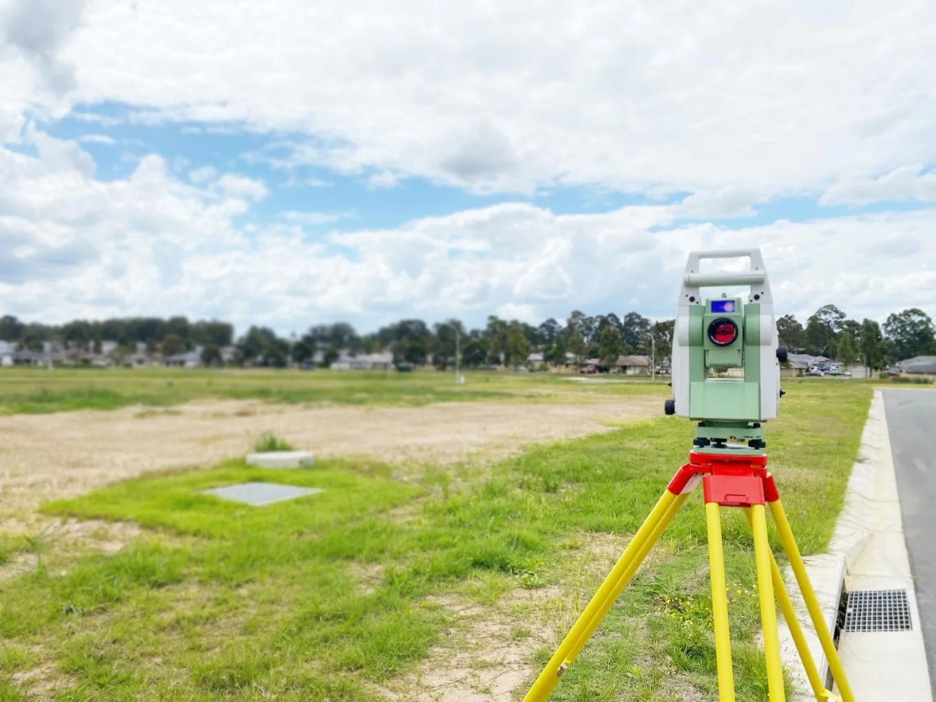
A land survey is the process of precisely measuring and mapping a parcel of land to determine its boundaries, features, and legal dimensions. These measurements are conducted by a Registered Surveyor, accredited by the Board of Surveying and Spatial Information (BOSSI) in New South Wales.
The resulting survey plan serves as an official record for property ownership, development applications, and construction planning. In essence, a land survey ensures that everything built or purchased sits exactly where it should — within the legal property lines.
When Do You Need a Land Survey in Newcastle?
There are several situations where engaging a professional surveyor is not just recommended, but necessary:
- Buying or Selling Property: Verify exact property boundaries before completing a sale or transfer.
- Building a New Home or Extension: Ensure structures are positioned correctly within your lot.
- Subdividing Land: Comply with Newcastle City Council and NSW Land Registry requirements.
- Installing Fences or Landscaping: Avoid costly encroachments on neighbouring properties.
- Submitting a Development Application (DA): Most councils require an up-to-date, certified survey plan.
If you’re undertaking any of these projects, professional land surveyors in Newcastle can help identify your exact property boundaries and prepare documentation that meets council and legal standards.
Types of Land Surveys Available
Depending on your needs, a range of survey types may apply:
- Boundary Survey: Defines legal property limits for ownership, fencing, or dispute resolution.
- Detail & Contour Survey: Maps land elevations and features for architects and engineers.
- Subdivision Survey: Splits one parcel of land into multiple lots, ensuring compliance with local regulations.
- Construction Set-Out Survey: Marks out building positions and foundations on-site before construction begins.
- Identification Survey: Confirms whether existing structures sit within legal boundaries — often required for refinancing or council compliance.
Local Factors That Make Surveys Essential in Newcastle
Newcastle’s geography and property landscape create unique challenges that make professional surveying particularly valuable:
- Coastal and hilly terrain: Areas across Newcastle, Lake Macquarie, and Charlestown feature uneven ground that can affect boundary accuracy and building alignment.
- Older suburbs: Many established areas such as Hamilton, Merewether, and Cooks Hill have legacy property boundaries that may not align perfectly with current cadastral data.
- Urban redevelopment: As older sites are redeveloped, ensuring accurate boundaries prevents legal issues and simplifies approval with Newcastle City Council.
- Council and state requirements: Most developments require certified survey plans for planning and construction approvals.
For reliable, location-specific insight into these conditions, experienced land surveyors Newcastle can assess your property and provide the precision mapping needed for smooth approvals and confident project planning.
Benefits of Getting a Land Survey
Investing in a professional survey offers a range of long-term benefits:
- Prevents disputes with neighbours over boundary lines.
- Provides reliable data for architects, engineers, and builders.
- Streamlines Development Application approvals.
- Protects your property rights and long-term value.
- Delivers peace of mind before construction or purchase.
Why Choose a Registered Surveyor in Newcastle
Only Registered Surveyors under BOSSI NSW can legally certify survey documents used for property transactions and council submissions. Choosing a qualified professional ensures your project meets state standards and avoids potential legal issues.
Look for surveyors with strong local knowledge of Newcastle’s regulations, transparent pricing, and advanced tools such as GPS, drones, and 3D scanning for greater accuracy. A local team that understands the Hunter region’s terrain and development processes can make all the difference.
Frequently Asked Questions
How much does a land survey cost in Newcastle?
Residential boundary surveys typically start from $700–$1,500, depending on site size and complexity.
How long does a survey take?
Most residential surveys are completed within one to three days, while larger developments may take longer for data processing and certification.
Do I need a survey for fencing or renovations?
Yes. Even small structures like fences, sheds, or driveways benefit from a survey to ensure they sit entirely within your property boundary.
Bottom Line
A professional land survey isn’t just about maps and measurements — it’s about protecting your investment and ensuring every property decision you make is backed by precise, legal data.
If you’re buying, subdividing, or developing property in Newcastle or the Hunter region, CitiSurv’s team of registered land surveyors can help you define your land with confidence.
Get in touch today for expert advice and accurate, council-approved surveying services.